Our Mission
Deliver dependable, cutting-edge tools for subsurface imaging—helping teams make confident decisions in real-world field conditions.
We deliver high-performance geophysical instruments and field-ready solutions for subsurface investigation, environmental assessment, and infrastructure diagnostics.
Infinite Geological Solutions provides advanced geophysical instruments and services for professionals. Our mission is to make subsurface exploration more accurate, reliable, and accessible—backed by practical field experience and modern engineering.
Deliver dependable, cutting-edge tools for subsurface imaging—helping teams make confident decisions in real-world field conditions.
Become a trusted partner for geophysical solutions worldwide by combining innovation, support, and practical application expertise.
Responsive support, proven product lines, and a focus on long-term value—so you can deploy, measure, and interpret with confidence.
A curated portfolio of instruments for common subsurface workflows—from utility detection to deep investigation. Explore product categories below or contact us for a tailored recommendation.
| Capability | GPR | Seismic | Res/IP | TEM |
|---|---|---|---|---|
| Utility detection | ✓ | — | — | — |
| Shallow stratigraphy | ✓ | ✓ | ✓ | — |
| Engineering assessment | ✓ | ✓ | ✓ | ✓ |
| Groundwater mapping | — | ✓ | ✓ | ✓ |
| Mineral exploration | — | ✓ | ✓ | ✓ |
| Fast deployment | ✓ | — | — | — |
GPR systems support rapid, non-destructive subsurface imaging for utilities, concrete inspection, archaeology, and near-surface mapping. Configure antennas and workflows to match depth and resolution requirements.
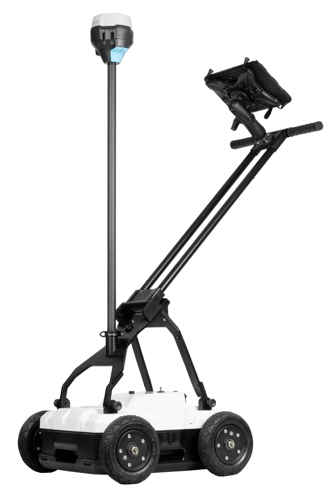
MALÅ Easy Locator Core is a state of the art, intelligent ground penetrating radar solution for utility locating professionals.
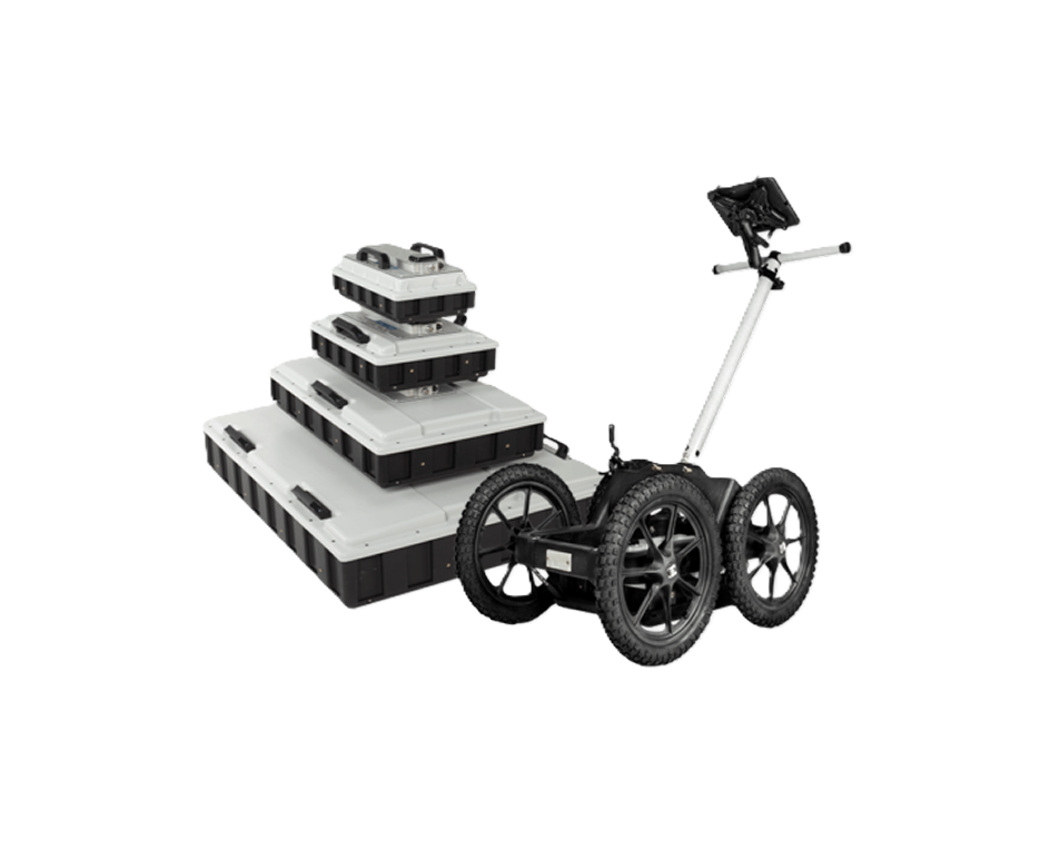
MALÅ Easy Locator WideRange is a dual antenna choice for utility mapping, with added post-processing and positioning features.
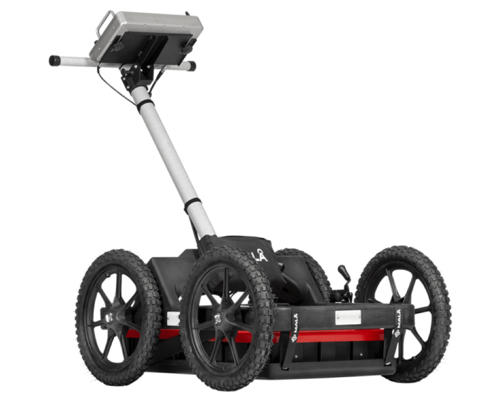
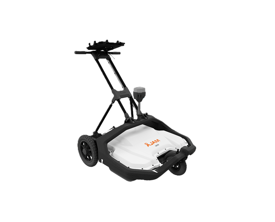
MALÅ Ground Explorer (GX) is an integrated GPR solution with a wide range of antenna options.
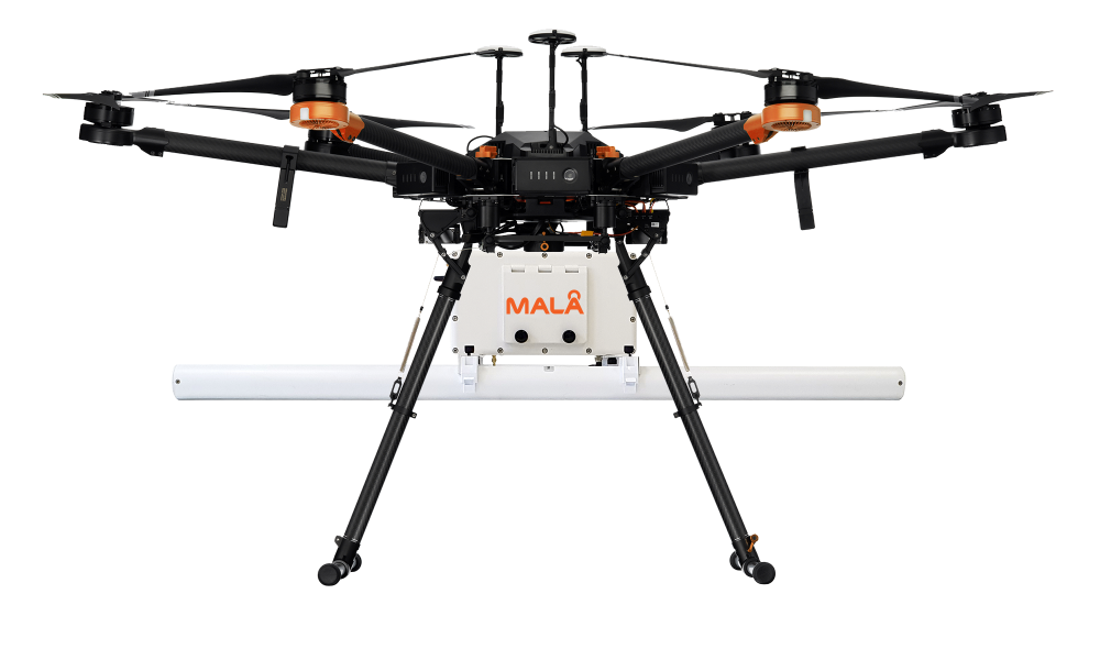
MALÅ GeoDrone is an airborne GPR solution for efficient field work, designed specifically for data collection in remote, hazardous and in-accessible areas.
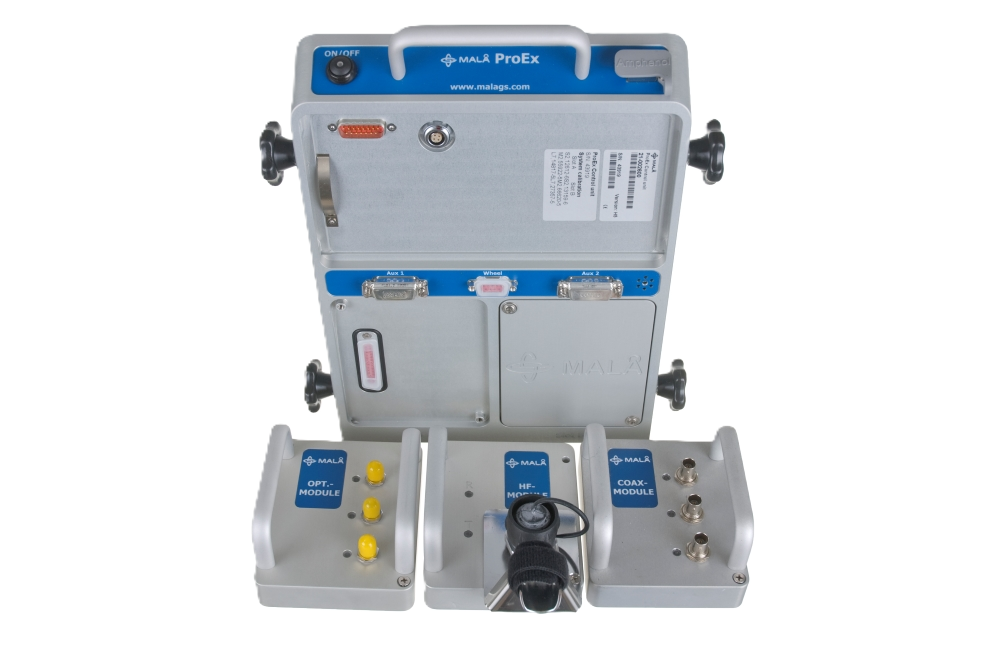
MALÅ ProEx is fully compatible with a broad range of MALÅ GPR antennas, and offers a flexible and versatile GPR solution.
MALÅ 3D Imaging Radar Array (MIRA) Compact is a high-speed, one-pass 3D GPR system and the most effective solution for large-area GPR mapping.
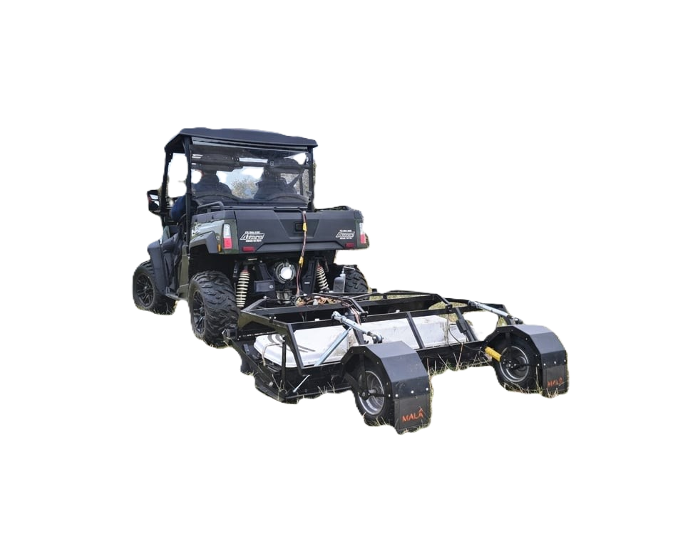
MALÅ MIRA HDR is a cost-effective 3D GPR array for mapping large areas to locate buried objects and artifacts. Used in utility locating, road surveys and bridge deck scanning.
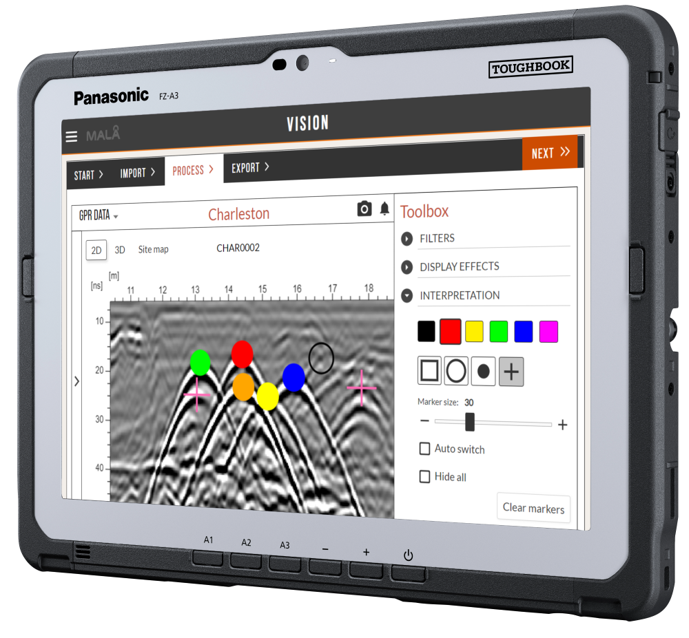
MALÅ Vision Software is an easy-to-use cloud-based GPR software for efficient data processing.
Seismic solutions support characterization of subsurface layers and mechanical properties for engineering and exploration studies, including refraction, MASW, and more.
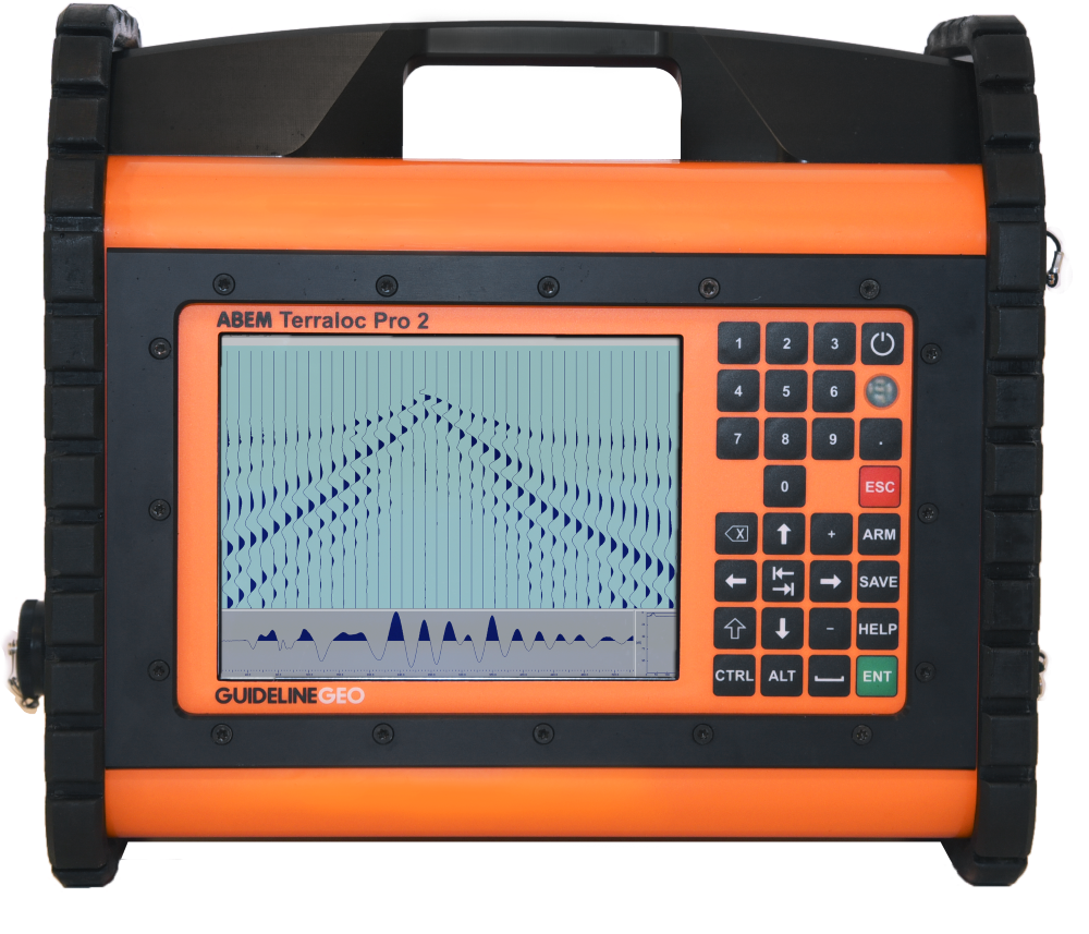
The Terraloc Pro 2 is a tough and versatile seismograph that offers the flexibility to undertake reflection, refraction, surface wave and borehole surveys with a scaleable hardware design to perfectly meet your needs.
Electrical resistivity and IP help map subsurface resistivity contrasts, groundwater targets, and mineralization indicators. Scalable layouts support small sites through larger arrays.

The ABEM Terrameter LS 2 is a flexible resistivity and IP instrument, ideal for VES and/or ERT surveys. Whether it is repeated autonomous monitoring across an electrode layout of hundreds of metres or a one-off measurement on centimetre-spaced pins in a laboratory model, the Terrameter LS 2 does it all.
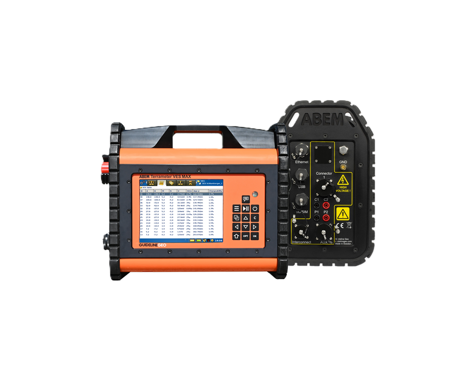
The ABEM Terrameter VES MAX is an instrument for 1D resistivity and IP, aimed at those with serious aspirations to start doing ERT in the future, and those with the budget for a fully-specified VES instrument, capable of advanced functionality.
The ABEM Terrameter Log 300 is a plug-and-play borehole logging tool for recording resistivity, IP, SP and temperature. In general, it can be used in any application where greater resolution and/or direct measurement of resistivity is required at depth.
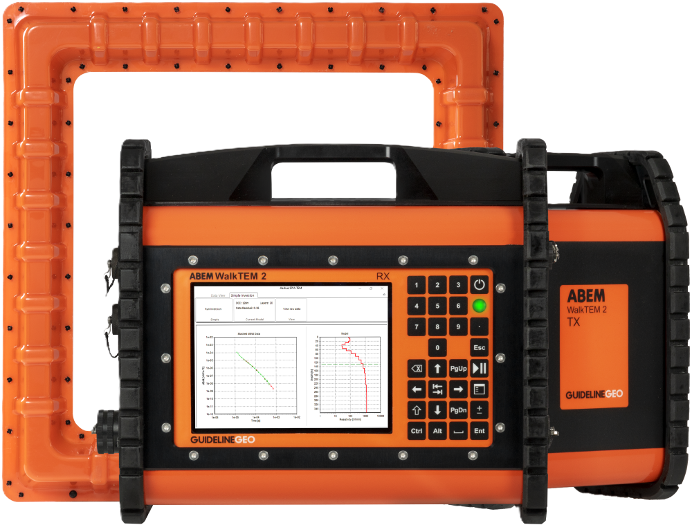
TEM enables deeper investigation of conductive structures, groundwater resources, and geological interfaces. Suitable for reconnaissance and detailed studies.
A scalable system for precise resistivity models.
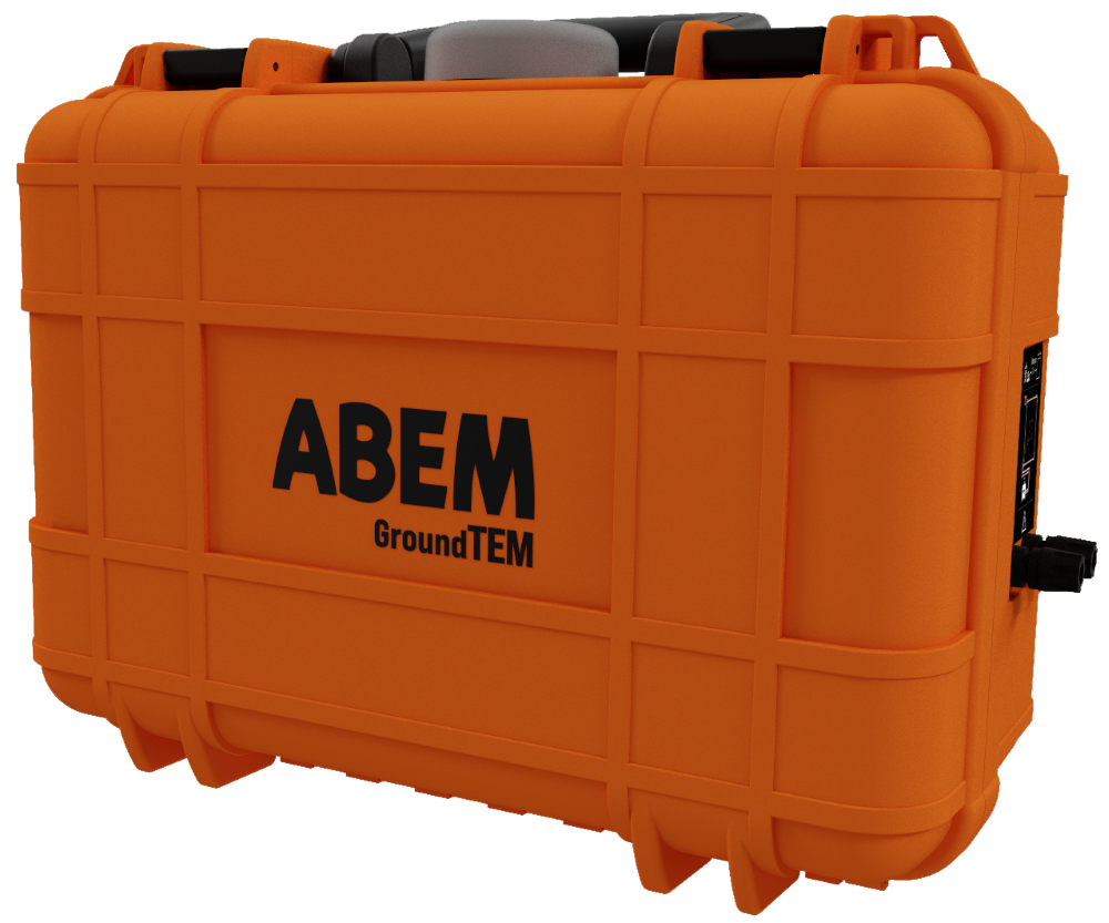
An affordable app-controlled entry-level TEM system.
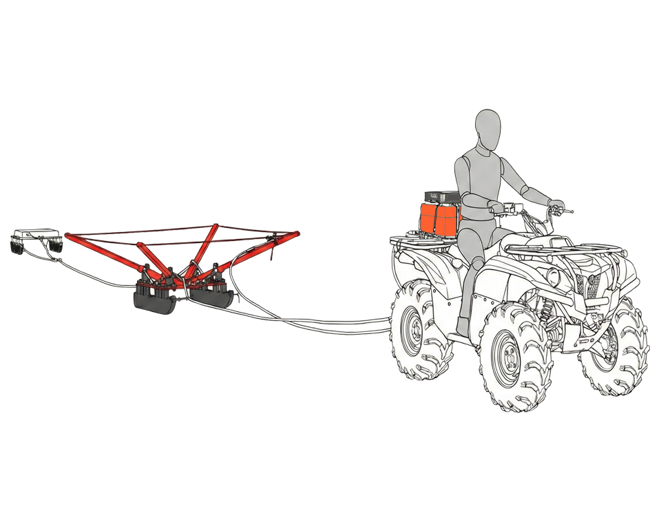
Efficiently surveys areas providing detailed subsurface images with 2D profiles.
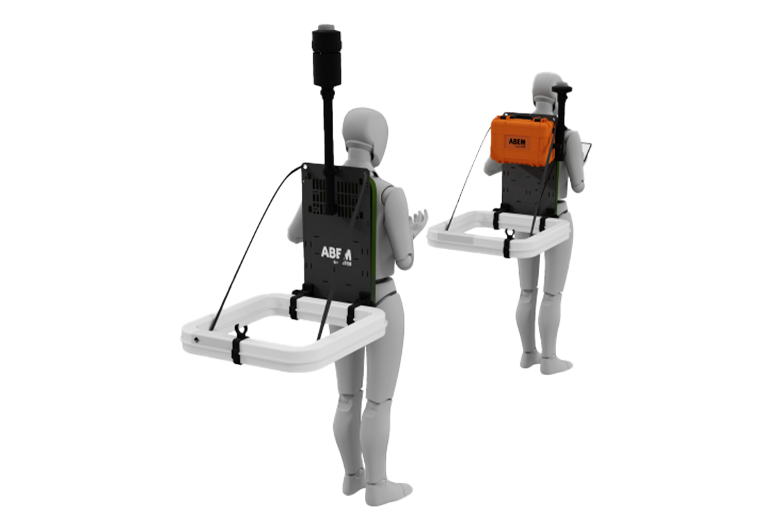
A backpack-mounted mobile TEM solution for rapid groundwater and environmental mapping.
Tell us about your project goals and preferred product line. We’ll recommend the best-fit configuration and next steps.